The Spiritual Variant – 125 Mile Pilgrim Finale

During our planning of this adventure, many had recommended that we do the Spiritual Variant of the Portuguese Way. It added a little more distance and included a boat ride up a river. We were told it was very special and quite beautiful. Pontevedra was where those taking the Spiritual Variant broke off from the main Portuguese Way. It had a lot less pilgrims and was very magical.

Pontevedra to Armenteira. 9.64 miles/15.5 km and 1519 feet/463 m of elevation

This was another brutal stage. Although shorter in distance, it was more elevation in a shorter amount of time. Ummm….I do not believe I was told about all these elevation stages! I was only aware of one! Apparently, I need to do my own research to see what I am truly getting into! The climb was relentless! If you recall from our last post, we had quite a bit of fun late into the night yesterday. As a result, Dan was suffering beyond belief (the result of mixing beer, wine, 4 different liqueurs, and port….I stuck to wine and the liqueurs). While he lamented the grueling hill in pouring rain, threatening to vomit on a regular basis, I dug my heels in and did my penance. I charged up the hill forcing myself to conquer it, leaving Dan far behind. I’m such a bad wife. Along the way, there was a drink station set up for pilgrims. It’s a help yourself set up with the request of a small donation if you can. Dan stopped and purchased an orange soda (something he never drinks and loaded with sugar). That was just the hit he needed, and before long he caught up with me. Unfortunately, his sugar rush only lasted about 45 minutes. Luckily, we were finely at the top. Now time to go down.

While up was certainly not much fun, down turned out to be just as bad. Thanks to days of rain, our descent was through thick and slippery mud and ponds of water (all in the pouring rain and wind). Near the end, we encountered rocks and boulders to down climb. Between the slickness of the rocks and my heavy pack (and gravity not working in my favor), I chose to slide down them on my ass. We finally arrived at the monastery in Armenteira., soaked to the bone and shivering. We headed inside and got our passports stamped by a monk. Now we had to figure out how to get to our lodging which was a 15 minute drive out of town. There were no cabs available as school had just let out, and they were busy shuttling kids. The owner of the guest house finally took pity on us and came to get us. It was a lovely stone house with a communal sitting area and 6 guest rooms. Unfortunately, the heat would not turn on until late into the night. A hot shower helped a bit, but Dan spent the next few hours buried in the bed under all the blankets. Yes, he was still sick from last night’s fun. I, on the other hand, enjoyed a light snack of local mussels and olives and a glass of local wine. It was a good thing since our overpriced dinner at this guest house was extremely meager and not very good. That was a disappointment. We did meet a gentleman from the Netherlands who was 70 years old and doing his 4th Camino! We also met a woman from Latvia. The 4 of us were all staying at the guest house. We left ahead of the others the following morning. Once again, we were trying to find weather windows with the least amount of rain.

Rain, rain and more rain!
Poio Monastery
Pilgrim encouragement!
Donativo- it’s a donation based fridge stocked with sugary drinks for energy for the big hill.
Trail was slick in many places from the rain
Monk stamped our credentials at the Monastery
Steep hill!
We met a 70 year old Danish man who was on his sixth Camino

Armenteira to Barrantes 4.38 miles/7 km and 65 feet/20 m elevation

We had a taxi come get us to bring us back to the monastery (it was important to us to resume our journey from where we left it and not shortcut it). We decided to make our trek short today since the rain was forecasted to get much worse. This leg was absolutely stunning (and a little scary). It is known as the Ruta da pedra e da auga which means the route of rock and water in Galician. Since arriving in Spain, we have been in the region of Galicia so my limited Spanish abilities were of less use since Galicia has its own language. Anyway, our journey today had us following a raging river with lots of rushing waterfalls. The surrounding area was very lush and tropical which also meant climbing over some downed trees from the bad weather. You may be wondering what is so scary about that? Well, thanks to days of heavy rain, the ground was again very muddy and slick. Often times, we were right at the water’s edge. One slip into the raging water would have been deadly. We also had to traipse over wet boulders and walk through mini waterfalls that cropped up because of the rain runoff. To give you an idea of the how rough it was, it took us 45 minutes to cover 1 mile (our entire journey to this point averaged just under 20 minute miles). This route use to contain a number of water mills. A number of the decaying, stone structures still dotted the banks of the river. This portion of the trek had been all downhill (finally!) which meant our entire elevation gain today was getting to our room. Once again, we arrived soaking wet and muddy. Man, I knew we might get some rain this time of year but geez! Enough!

“Route of rock and water” – a highlight of our Camin0
Beautiful hike!

Barrantes to Villanova de Arousa 10.34 miles/16.6km and 430 feet/131 m elevation

Surprise! Another day of rain forecasted. We tried to find the best window to start our next stage. The day started out with drizzle as we trekked along the banks of another river. Unfortunately, because of the endless days of heavy rain, parts of the river had overflowed the banks (and thus our trail). We were quickly getting wetter and wetter trying to navigate through the ponds of water. An hour and a half into our journey, we hit the big river overflow. It was clear that those who came before us strayed off trail into the tall foliage in an attempt to find higher and drier ground. As we followed their path, the water had already risen to the point that there was nowhere to go but through. As the crushed plant life began to sink beneath our feet, we were now calf deep in water. The river had bested us. We now had 2 hours left in our journey in sopping wet sneakers, two pair of wet wool socks, and wet pant legs….yuck. Our resilience on this pilgrimage was definitely being put to the test. Our final 20 minutes of walking, the rain poured down on us. Why wouldn’t you want your top half to be as wet as your bottom half?!? This also meant the arrival of our first blister. We were about to finish the Spiritual Variant of our journey and rejoin the main Camino route.

The next morning involved a boat ride up the river to the city of Padron. There would be no walking today and of course, no rain. This was a good thing since it was cold and windy on the boat ride, so rain would’ve really sucked. As we cruised up the river, we passed through 2300 mussel farms run by individual families. This area is the largest exporter of mussels. Each platform consisted of 200 ropes. Each rope was capable of growing 250-300 kg/551-661 pounds of full grown mussels. Also along the river route, there were 17 crosses to commemorate the journey of St. James’ body. At one spot, there were 3 crosses together which were said to represent St. James and the two disciples that traveled with his body from Jerusalem (it is the local interpretation). Another cross on the river has its post completely submerged during high tide leaving only the cross itself visible on the water. The next cross we encountered was named Pisa. The story was that the workers installing it had taken a lunch break which involved a few bottles of wine. They went back to work after lunch, and the cross was installed with a very evident lean to it. From there, we passed by some Viking tower ruins from the 9th and 10th centuries. This area was a Celtic town that frequently fought the northern countries of Europe. Beside the towers are 2 replicas of Viking ships. In August, the town re-enacts the battle between the locals and the Vikings. It is supposedly quite the event to see. An hour and a half later, we arrived in Padron. Unfortunately, it was a holiday in Padron so many things were closed. We did walk the town which was quite beautiful, went into a few churches, and enjoyed a big concert in the square. Since this is where the Spiritual Variant of the Camino and the Portuguese Way intercept, there were many, many pilgrims here. It was hard to believe that we were almost done with our 194 km/120.5 mile trek. We were excited about our accomplishment but also feeling oddly sad that it was coming to an end. How weird is that?

Onwards on the Spiritual Variant!
Arriving in the seaside town of Vilanova de Arousa
Boat trip on the “Maritime Way” retracing the path to Santiago of St James’s remains
17 stations of the Cross along the way
Ancient Fortress defending the town of Padron from Vikings
Replica Viking longship from days long ago
Padron
Padron Cathedral
Springtime in Padrón

Padron to Milladoiro 11.84 miles/19km and 1182 feet/360 m of elevation

Video warmup of our penultimate stage

The last stage of the Portuguese Way goes from Padron to Santiago de Compostela. Given that there was a decent amount of elevation remaining (almost 1700 feet/518 m), I was not sure I could handle 17 miles as well, all in one go. I also figured that getting in to town the next morning would make for less pilgrims arriving at the office to get their certificates. Based on the number of pilgrims we encountered in Milladoiro, it appeared we all had the same thought…haha. This was our last big day. Tomorrow’s trek into the old city would be a short one. It felt so strange to not have any more big days ahead of us.

As you get closer to Santiago the number of fellow Pilgrims on the trail increases a lot
Less than ten miles to go!!!

Milladoiro to Santiago de Compostela. 5.29 miles/8.5 km and 504 feet/153m of elevation

We made it! Not only that, but we arrived on my birthday. We rolled into Santiago de Compostela early in the day and headed straight to the pilgrims office. We received a ticket number for our spot in line. We were pilgrims number 118 and 119 out of 2,037 that arrived that day. We answered some questions, showed our stamped passports and were given our certificates of completion. It was quite a fast process which was very unexpected based on all we had seen and heard. This is also where I chose to leave my final rock. I saved my favorite one for this special place. I had picked this one up on the trails around our house during our training hikes. It was striped and glittery and shaped like a heart.

Our hotel was right in the heart of the old city which was spectacular. We visited the focal point of the city which was the St. James Cathedral. It was beautiful. We also saw the tomb of St. James. That night, Dan took me to a Michelin star restaurant for my birthday where we had a wonderful tasting menu. The following day we attended the pilgrims mass which acknowledges all the pilgrims that arrived the day before. The mass was done in Spanish, and we are pretty sure we heard the word Arizona. We assumed that maybe they mentioned the furthest location of the pilgrims arriving the day before. Who knows? It was a nice experience even if I could only understand about a third of it.

On our last day, we took a train to the beach town of A Coruna. This turned out to be a much larger city than we imagined. It was about a half hour walk to the seaside and also where the cruise ships arrive. We wandered the old town here for a bit, had some octopus and calamari for lunch, then headed back. Back in Santiago de Compostela, we explored a few museums. One of the museums was a Pilgrims Museum which detailed the history of the St. James pilgrimage through history. I was somewhat reluctant to go (boring), but it was actually quite fascinating.

We spent 2 nights and 3 days in Santiago de Compostela, but the time had come to return to Zoe and finish up our work….boo. They say these pilgrimages are addicting. I laughed at that. How crazy! Oh, how wrong I was! Before we even finished, we were discussing which one would be our next and how soon we could do it. Spoiler alert….our next one is almost fully planned, and in this very same year. Go team Muzich! Thanks for joining our adventures!

The first time in 125 miles the arrows were unclear of which way to go!
Video of last stage thoughts on our Camino
The destination of “The Way” – 11th Century Cathedral in Santiago de Compostela
On line at the Pilgrim office to get our credential processed
We received certificates attesting to completing the Camino
Robyn showing the two stamps a day in our Credentials
Dan is proud of his hard won Pilgrim Credential as well!
Robyn placing her last “burden” at our destination
Collection of Pilgrim burdens at finish
Pilgrim mass honoring those who arrived the day before
Viewing the Tomb
The Tomb of St James

2 Peregrinos on the Camino de Santiago

After several fun filled days exploring the city of Porto, it was finally time to make our way to the starting point of our 194 km/121 mile trek of the Camino de Santiago.  We hopped on a train for the 1 hour ride from Porto to Barcelos.  From the train station, we had a 20 minute walk to the city center.  Something big was underway, as the streets and alleyways were lined with beautiful lighted sculptures, colorful flags and banners, and hundreds of students lining the streets getting ready to march in a parade.  It turned out to be a celebration of Portugal’s liberation 50 years ago.  It was fun to be in the center of all the excitement.  We only had the one evening in Barcelos before starting our Camino trek the following morning, so we wandered the city center and found a cafe that catered to Camino pilgrims (peregrinos).  For $5 euro each, we had a big bowl of hearty soup with bread, a plate full of food, and a large glass of wine.  What a deal!  All throughout the city, there were these bright and colorful roosters of varying sizes.  The rooster is quite famous, and the story quite intriguing.  I will give you the short version but highly recommend looking up the more detailed version.  Basically, the folk tale is that a dead rooster crows to prove an accused man’s innocence. There are a number of variations on the basic theme and all are quite fun to read.  Needless to say, we purchased a small version of the colorful rooster that adorns the town.  We turned in somewhat early in preparation for our long walking days ahead.

The pretty town of Barcelos – our Camino starting point
The famous rooster of Barcelos
Pilgrims canteen – hearty and cheap fuel for trekkers

Day 1:  Barcelos to Balagues – 11 miles/18 kilometers

The first part of this trek was definitely not my favorite.  We walked through town and along busy roadways without sidewalks making me very uncomfortable from a safety standpoint.  Plus, this was not at all what I pictured in my head.  A tradition on the camino is to carry a rock from home that serves as a symbol of your burdens.  During our hikes around our house, we had carefully chosen several rocks, unique to our area, that would represent our burdens.  I decided to leave one at the start, one at the border between Portugal and Spain, and the final one at the Cathedral of St. James.  As we began to leave the town behind, we came across a stone cross which seemed like the perfect place to leave our stone.  Dan asked if I had left my burden behind to which I replied, “no because you’re still here.”  Haha….just kidding!  We both laughed.  Eventually, the path meandered into the countryside where things were much more tranquil and serene.  The countryside was beautiful and ever changing.  3 hours and 45 minutes later, we arrived in Balagues very tired and very sore.  We arrived at our accommodation where we were greeted with an ice cold beer.  Man, that was the best beer ever.  Our room was quite amazing as well.  Cut into stone archways with wooden doors and shutters, maroon tapestries and a canopied bed, it looked like a room in a castle.  Unfortunately, we did not read the small print (ok, not so small) on our peregrino passports that says you must get 2 stamps every day on our journey.  Awww man!  Our only option was this 1 restaurant which was a 20 minute walk away.  So, despite being exhausted and sore, we made the journey to the restaurant.  We pre-ordered (the restaurant actually called us ahead of time to get our order) the grilled cod (salted cod is very famous in Portugal and we had been eating it in a variety of ways since we arrived).  When it arrived, we were both shocked at the ginormous piece of fish that sat between us.  Yikes.  Oh, the lengths you will go to in order to ensure you have the required number of stamps.

121 miles to go….all on foot!
Getting our Pilgrim Passport it’s first stamp of many
We brought some rocks from Arizona as a symbol of “leaving burdens behind” on the Camino
Robyn settling nicely into trekking long distances
First day video recap
The hotel welcomed us with cold beers. Perfect after a day on the Camino!
This was one of favorite rooms of the trip!
The largest piece of seafood we have ever had for dinner!

Day 2:  Balagues to Ponte de Lima – 12 miles/20 kilometers

We hit the trail fairly early again since we had another long day ahead of us.  I forgot to mention that when we began planning this journey, the requirement to acquire your certificate of achievement was to walk at least 100 kilometers.  Since we (Americans) don’t really operate in kilometers, I told Dan we should just make it an even 100 miles.  I was also told by Dan that the average miles per day was 10.  When we set out, I began to question how he managed to sneak in an extra 21 miles?  He then told me that it was actually more than that since we were adding in the spiritual variant!  What?!  I then questioned how we were getting a 10 mile average when these first two days were over 10 and none of the upcoming days were ever under 10.  He then tried to tell me that he said it was the median not the average.  Oh no you don’t…..I know exactly what you said and it was not median.  I have now threatened to record our conversations.  Ahhhh, the conversations you have while walking for many hours.  3 hours and 57 minutes later, we arrived in the city of Ponte de Lima (once again, exhausted and sore….I am sure that surprises you).  Here we had a nice room in the heart of the city.  After a little bit of a rest, we headed out to explore the city and grab some dinner.  It’s amazing how much lighter and faster you feel on your feet once you ditch the 20 pound backpack!

Ticking the the KMs (and miles!) down
Spring time scenery was wonderful
Wonderful trekking
Ponte de Lima – our stop for the night
Our guest room was in a great location in the heart of the town
Enjoying some local lamb after a day of trekking
Day 2 video recap

Day 3:  Ponte de Lima to Rubiaes – 11.6 miles/19 kilometers and 1804 feet/545 meters of elevation gain!

As we were checking out of our room in Ponte de Lima, our young host told us to please enjoy breakfast.  We politely explained that we really weren’t hungry and thanked her.  She got this very concerned look on her face and told us to please take some of the food with us.  We explained to her that we really don’t eat breakfast and typically won’t eat until late afternoon.  She looked a bit horrified, bagged up some croissants and begged us to please take them with us.  We agreed and were on our way.  As we walked along, we both were chuckling at how insistent she was that we have food.  This was a beautiful part of the trek through very lush forests.  The trail was great and the smell of pine permeated the air.  This was really cool….until it wasn’t.  We had to come up and over the mountain!  It was relentless climbing over tree roots and rock gardens….footing very unsure.  Every inch of our lower body was on fire!  I now understood why our young host was so concerned that we were not eating breakfast and didn’t want to take any food with us.  SHE knew what we were going to be facing.  I can’t tell you how relieved we both were when we finally reached the top!  All downhill from here.  We stopped just on the outskirts of town (as did many pilgrims) for a much needed ice cold beer…ok, maybe two.  4 hours and 26 minutes after starting, we arrived in the small town of Rubiaes and checked in.  Unfortunately, this very small town had very few options for both restaurants and lodging.  Since I am way to old (and sleep challenged) to stay in hostels with 30 or more of my closest friends, Dan worked very hard to make sure he booked us private rooms wherever he could.  This was probably my least favorite lodging as we had 2 twin beds that were like sleeping on cement.  Oh well, beggars can’t be choosers.  On top of it all, it had started to rain and the only restaurant in town was closing up for siesta when we arrived (we were starving by now).  So, we got to walk there and back twice after our big day!

Across the medieval Ponte de Lima Bridge
You meet many nationalities on the Camino
The trail is starting to get a bit steep!
And even steeper!
The summit was an ideal location to leave symbolic rocks of “burdens left behind”
The Apple watch tells the tale – over 1600 feet elevation on this stage
Video recap
Guest house was a welcome sight after a difficult day!

Day 4:  Rubiaes to Valenca – 10.24 miles/17 kilometers

Today came with rain.  That should make things interesting.  Our host had told us that today would be a much easier day after yesterday.  That was a huge relief.  By the time we got started, the rain had become a steady drizzle.  Not too much trouble, but it did make footing interesting.  A large portion of the path was cobblestone blocks which became slick in the rain.  Other sections were dirt which became mug bogs and required carefully picking our way through.  We were once again enveloped by lush green trees and shrubbery in some areas, beautiful swaths of flowers in other areas, and large vineyards as far as you could see.  We followed streams and rivers with many small waterfalls and farm areas with sheep, lamb and cows.  It was beautiful.  Everywhere we went, locals and fellow pilgrims wished you a Bom Dia (good day) and Bom Caminho (good camino).  3 hours and 28 minutes later, we arrived in Valenca,

wet and bedraggled but feeling pretty good.  Wow….were we acclimating to these long days of walking?  We had a lovely apartment booked inside the fortress walls.  This was our last stop in Portugal before crossing the border into Spain.  I’m not going to lie, I was feeling a little sad to be leaving Portugal behind.  This was my first time here, and I really loved it!  Although very crowded with tourists, we enjoyed wandering the cobblestone alleyways and exploring the small shops and cafes.  In the center of the square we enjoyed some drinks while listening to a man belt out some old American classics.  Most of the pilgrims we encountered weren’t staying in Valenca.  Many pass on through to the town of Tui which is only a mile and a half across the river to Spain.  Since we really wanted one more night in Portugal, we decided to build in a rest day by staying in Valenca and crossing to Tui the following day and staying a night there.  We had a leisurely morning in Valenca before making our way to Tui.

In order to keep this somewhat manageable for you, the reader, I will end this post with the Portugal section of the Camino.  Our next entry will pick up with the Spain portion as we make our way to the Cathedral of St. James in Santiago de Compostela.  We’ve included some video clips in the hopes of giving you a better sense of the experience.  As always, thank you for following along and hope you enjoy!

Vineyards are everywhere on this trek
Cafe’s were a great place to take a brief rest and enjoy well made cappuccinos
Valenca – last stop in Portugal
Walled fortress of Valenca
Video recap of the day

Adventures in Lisbon and Porto

Our adventures this month continue to require maximum flexibility on our part.  The original plan was to work on the boat, supervise the installation of the new standing rigging, and then fly out to Portugal for some exploration before beginning the Camino de Santiago.  We encountered a hang up with the materials for the standing rigging, so we made the decision to head to Portugal early before returning to the boat to finish up the work.

We arrived in Lisbon late in the evening and grabbed a Bolt (like Uber) to our apartment in the heart of Lisbon.  It turned out that our driver was also a tour operator, so we were able to arrange a 9 hour private tour of the highlights in and around Lisbon.

The next day we headed out on foot to explore the beauty of Lisbon.  Lisbon is extremely hilly with many, many staircases throughout the town.  Our apartment was also on the 4th floor, so the amount of climbing we did over the few days we were there was phenomenal (and exhausting).  As with most European cities, the old town was lined with quaint little alleyways and cobblestone roads.  There were many small cafes and restaurants tucked up in alleys and in the main squares.  Cathedrals and churches were all around.  After a long day of exploring the surrounding area, we returned to our room for some rest before heading out later that evening for a 4 hour Portuguese cooking class.

We left a little early for our class to sample some of the local wines and a sour cherry liqueur, Ginjinha, which is a specialty of the area.  Everything was quite delicious.  When we arrived at the cooking school, we were greeted by the chef and met the 10 other people in the class with us.  8 of us were from the U.S. and 2 were from Portugal.  The class was structured a little bit different than ones we have done in other countries.  Here we would be making many different dishes, so each of us took on a variety of different tasks.  Throughout the experience there was wine…..lots and lots of wine!  We began with a charcuterie board of local cheeses, meats and bread as well as a fired chorizo.  Then it was time to cook.  We made cod fish croquettes, chicken gizzards, a marinated chicken, tempura fried long beans, a carrot dish, a rice dish, and an orange dessert.  Once everything was prepared, we all sat down to enjoy the food we had made.  We were sent all the recipes which we can’t wait to try out (maybe not the gizzards) when we get home.

The following day would be our last day in Lisbon.  Our driver picked us up at 9:00 a.m. for a full day of exploring before catching a 7:00 p.m. train to Porto.  Our first stop was a famous pastry shop (Pasteis de Belem) known as the original place of the Pastel de Nata, a Portuguese custard tart.  We bought several to enjoy later (that was a mistake – they are best enjoyed fresh from the oven!) From there, we headed to the river front where we explored a monument dedicated to explorer Vasco de Gama and the famous Belem tower.  We drove an hour outside of Lisbon to a lovely town called Sintra, home of the summer palace of Portuguese royalty.  We climbed steep hills and walked hundreds of steps to explore this amazing garden,  Reguleira, with an “inspiration well” that spiraled deep down into the earth where we then passed through long tunnels before popping out amongst waterfalls.  The grounds were very tropical and lush providing a sense of peace and serenity.  It was definitely scenery fit for a king.  Sintra is also home to Pena Palace, a 19th century castle (and UNESCO world heritage site) built by King Ferdinand.  

Pasteis de Belem – Home of the original Pastel de Nata
Pastel de Nata – the signature Portuguese dessert!
Monastery of Senhora and Tomb of Vasco de Gama
Belem Tower
Vasco de Gama’s starting point in 1497
Inspiration well in Reguleira
Pena Palace – Sintra
Castle fit for a King!

We toured many of the rooms inside the palace

I found it amusing when our driver told us that we would likely spend 2-3 hours in the palace.  Really?  That seemed like a really long time.  Nope, we spent that long!  By the time we hoofed it back down to the car, we were ready to take a break with a ride to our next site….Capo de Roca.  This is the westernmost point of Continental Europe.  The rock formations and crashing surf provided a spectacular backdrop.  There is nothing beyond this point until you hit North America.  Before long, we were making our way back toward Lisbon through a coastal fisherman’s village called Cascais.  The reality is that it was a fisherman’s village of the past.  Now, it is one of the wealthiest areas of Portugal boasting the pseudonym of the St. Tropez of Portugal.  For Dan and I, it was very reminiscent of driving through the ritzy beach towns of Southern California.

Westernmost point in Europe…
With our tour driver – Pramesh from Mozambique
Seaside town of Cascais

It was hard to believe how much we saw in our 9 hour window.  We loved every minute of it, but I would not recommend blazing through all these sites in one day.  Take the time to stop and really smell the roses.  You won’t regret it.  Sadly, it was time for us to say goodbye to Lisbon and make our way to Porto.  I wasn’t super excited by the idea of a 3 hour train ride (and that was the high speed version) nor arriving at our apartment after 10:00 p.m.  It had already been a really long day!

High speed train to Porto

The train ride turned out to be relatively painless and before we knew it, we were in the lovely riverside town of Porto.  Once again, our apartment was on the 4th floor.  The worst part was that there was a flight of stairs to get to the starting floor of 1, and each floor had 2 flights of stairs.  Our apartment was on the top floor which overlooked the city and rooftops which was absolutely stunning!  The downside was there were also 3 flights of stairs IN our apartment.

The next morning, we headed out on foot to explore the historic center of Porto.  Once again, we found ourselves climbing hills and hundreds of stairs to reach the many beautiful churches and cathedrals.  Just like Lisbon, the streets were crawling with people. Despite being April, tourist season was already in full swing….boo!  All around the town, musicians played beautiful music for coins and the hope you’d buy their CD.  The city runs along the river which has 7 beautiful bridges running across it.  On the opposite side of the river, there were many, many port (the wine) makers and tasting rooms.  

Azulejos of the Igreja do Carmo
Porto has a vibrant street music scene

On our next outing, we took the foot bridge across the river in search of some port tastings.  Our first stop was Calem caves where we sampled one port before deciding to move on.  We had been told by a friend to go to a place called World of Wine which consisted of many shops, restaurants and bars.  This was indeed a gem as it was very quiet and free from the hoards of people milling around.  We headed for a spot called Angel’s Share to enjoy a port tasting.  We were seated on a beautiful terrace overlooking the river and city center.  We were given 3 different types of port and an explanation as to what to pair them with.  Our tasting came with a tray of several different items:  cheese, rosemary sourdough crisps, pumpkin jam, carmelized walnuts, and a dark and fruity chocolate truffle.  It was amazing!  I am head over heels in love with the cheeses they make here, and the pumpkin jam they pair them with puts it over the top!

Bridge to Vila Nova de Gaia – home of famous Port wine
Most of the world’s port is produced in this area
Burmester Port wine cellars
Trying some Calem Port
An example of the river boats that delivered Port from the Douro river valley
Fun Port wine tasting at World of Wine

After our tasting we walked the riverfront and came upon this tall building with quite a bit of action going on.  As we wandered in, the walls rose 3 stories high and were lined with books.  The whole place was brightly colored and on the second level an organist played fun music like we were at some kind of old fashioned circus.  There were a couple of stations where you placed an order and received a cod fritter packed with hot, runny cheese and a large glass of port all served up on this small painters pallet that they hung over your thumb.  You could enjoy your treat in the place of walk the riverfront with your goodies and the glass and pallet were your souvenirs to keep.  Now that was fun!

Bacalhau (codfish) and glass of Port to go!

For our last night in Porto, we followed our friend’s advice again and made a reservation at a Michelin star restaurant called Elemento.  We felt very fortunate that we were able to get the reservation as it can be very difficult to get last minute reservations.  We opted to do the chef’s tasting menu which is always a lot of fun.  Tasting menus can always be a little challenging if you are like me and averse to some tastes and textures.  Every item was unique and unusual and everything hot is cooked over an open fire….no ovens or stovetops.  Most of the hot dishes had a bit of a smokey flavor or used a smoky flavored sauce.  We were treated to several seafood and meat tastings which included things like dried fish eggs on mackerel, raw shrimp, and venison loin.  It was a very nice experience.

Elemento Michelin starred restaurant in Porto

We were a little sad to be leaving Porto.  This was definitely one of my favorite stops despite the crowds, but it was time to make our way north and begin our pilgrimage of the Camino de Santiago….120 miles of fun filled walking!  Stay tuned as we trek our way from Portugal into Spain to the place where the Apostle, St. James, is interred.

Let The 2024 Adventures Begin

It’s hard to believe that the time had finally come to make our way back to Europe.  This year the trip back to Zoe had us flying by the seat of our pants and following some  rather unconventional routing.  To say that I am a high stress traveler would be a huge understatement and yet, I found myself very comfortably (and calmly) just going with the flow.  Well that’s an interesting twist!

It all began with a Sunday evening wedding in Las Vegas.  Our plan was to leave Vegas Monday morning on a flight to Los Angeles and then on to London.  Dan and I usually fly standby (Dan retired from American Airlines) which already makes travel very unpredictable (and yes, very stressful).  The empty flight we were listed on out of Vegas somehow filled up over night, and things only got worse as the day went on.  As far as the flights to London, Monday was our best shot at getting seats.  Flights to London got fuller and fuller as the week went on.  We made a last minute decision to drive to Los Angeles rather than fly.  Turned out that was a brilliant decision since the next flight out of Vegas cancelled and, we would have missed every flight available to us from Los Angeles to London.  As it was, we arrived at our gate within 30 minutes of boarding and standbys were already receiving their seat assignments.  Not only did we get seats together, but we got the last couple of seats in business class…..woo hoo!

One of the perks of being a retired airline person-standby travel for free

The majority of the flights that leave the US for Europe depart in the evening.  Our flight left early in the afternoon.  That turned out to be a rough flight since I can’t force myself to sleep in the middle of the day.  Oh well, I struggle to sleep on planes anyway.  Once we were cleared in London, our plan was to fly to Marseille, France (the closest airport to Zoe).  Well, that was a bust too.  The earlier flight to Marseille had cancelled which meant the one that we were suppose to take was now full.  My brilliant, travel planner husband quickly listed us on an open flight to Lyon, France.  This worked out great since we got our boarding passes right away despite being standby and seats together without a third person in our row.  Things really seemed to be turning out great!

Three flights and two unplanned rental cars but we made it

During all of this, Dan was quickly readjusting the pick up location of our rental car.  I am always amazed at his ability to pull off these quick itinerary changes on the fly (no pun intended).  From Lyon, we were going to fly to Marseille which would put us at a one hour drive from Zoe (versus 4 hours from Lyon).  At this point, I’ve been up for more than 24 hours and really have no desire to get on yet another plane for another flight to another airport.  We quickly strategized and decided that driving sounded better.  We figured we would drive and enjoy the beauty of the French countryside until Dan felt too jet lagged and tired to continue and, we would stop for the night.

We ended up stopping in the little town of Montelimar, home of the world famous nougat of France.  Dan found us a cute little apartment for the night before continuing on to Zoe the next day.  

Lovely place we booked enroute from Lyon to Marseille area in the French countryside

As we hit the road the following morning, we decided to stop for some much needed coffee.  We pulled over at this massive truck stop and headed inside for coffee.  Not only was the line for Starbucks huge, there were bus loads of kids milling about as if on a field trip.  On a side note, Starbucks in Europe is sooooo much better than in the US!  While Dan waited in line for our cappuccinos, I noticed a large nougat shop within the building.  I figured I’d go in and explore.  The amount and variety of nougat on display was mind numbing, and I’m not sure I even like nougat.  I selected a few small bags of several different kinds to try.  I mean, it’s world famous nougat from this town, you gotta try it….right?  FYI…..it was delicious!

We finally arrived back to Zoe by late morning.  We also arrived with a very strong Mistral (a strong wind that is famous in this region).  The winds were blowing between 30 and 65 knots!  It was hard to walk or even stand outside.  The waves on the Rhone River and nearby bay were pretty big for such small bodies of water (out on the sea, the waves were averaging over 15 feet!).  Talk about sapping your will to do work.

50 plus knots of Mistral wind greeted our arrival
Upon arrival to Zoe, the Mistral was blowing more fierce than normal. Our boat yard neighbors clocked 65 knots! Locals told us it was one of the worst.
Zoe looking pretty naked without her mast. She is 10 years old and in need of new standing rigging (the cables that secure the mast) especially if we are planning to cross the Atlantic.
60 feet of mast waiting for new goodies. Look how little Dan looks in comparison!
After 10 years in the heat and salt air, the seal around the doors became this gooey, tar like substance. It took me hours to clean the gunk out (never mind the sticky mess that ended up all over the boat which then also needed to be scrubbed)! Luckily, the installation of the new seals was quick and easy.
Our old lazy jacks (which guide the sails back into the bag) were extremely weathered and crusty. Time to make some new ones. Unfortunately, this is not a common knot for me, so I had to carefully deconstruct not only the crazy knots but how each line would run to the mast and through each pulley to the various connection points on the sail bag.
After a full day of frustrating work (and you can see the disaster behind that still awaits), you can’t beat our favorite Sardinian beer!

Zoe is always a mess when we return from being gone for so long, and this time was no exception.  If anything, I think she looked worse.  My heart sank.  The amount of work ahead of us seemed overwhelming, and in this wind the entire boat was shaking and rattling as it howled through the boatyard.  I was very worried the wind was going to knock us off our stand.  It was just as bad at the nearby lodge where we were staying.  The walls and windows shook violently for hours on end.  For me, the worst parts of owning a boat are getting her ready to launch and shutting her down for the season….a lot of work and no fun.  Everything in between is awesome!

These lodges aren’t far from the boatyard
After a hard day of work on Zoe a bit of local red wine and a sunset
Port St Louis du Rhone
Walks from the boatyard
The beach isn’t that far away
Our winter storage yard – this is the third country we’ve stored Zoe

Our plan is to be out here until mid May before returning home for the first birthdays of our granddaughter and grandson, then returning mid July to start the sailing season.  In the meantime, we are having a lot of work done to the boat in preparation for sailing her across the Atlantic to the Caribbean in the next year or two.  We have also been preparing for another bucket list adventure while we are here and out of the water.  While waiting for work to begin, we will be heading to Portugal where we intend to do an over 100 mile trek of the Camino de Portuguese following the path of St. James’ body to his final resting place in the Cathedral de Santiago in Spain.  Stay tuned for some fun and exciting land adventures in Portugal and Spain before we return to Zoe and then home. 

Onwards and Forwards!

Sydney Here We Come!

We bid a sad farewell to our very cool Cassowary friend.  Okay, not really a friend since he’d happily gut you if you made him angry, but he was cool addition to our camping experience.  Etty Bay was a small but beautiful little camp spot, but there really wasn’t a lot to do close by (and swimming was not an option), so it was time to hit the road.

Once last cassowary encounter before heading out. The four inch razor sharp claws were crazy.

Our next stop was the beachside town of Townsville (clever name, I know) on the Coral Sea.  Since we were now rolling into Easter weekend, the campgrounds on the water were quite filled with large groups and families.  We managed to score a nice spot across the street from the beach with a really nice boardwalk for strolling.  Our plan was to take the ferry across the sea to Magnetic Island where we had a 4 x 4 rented (the last vehicle available on the whole island) to go explore the sights.

Headed out on a ferry ride for an island adventure
Most of Magnetic Island is preserved as park. It got it’s name because Captain Cook’s compass stopped working when sailing by. It never happened again.

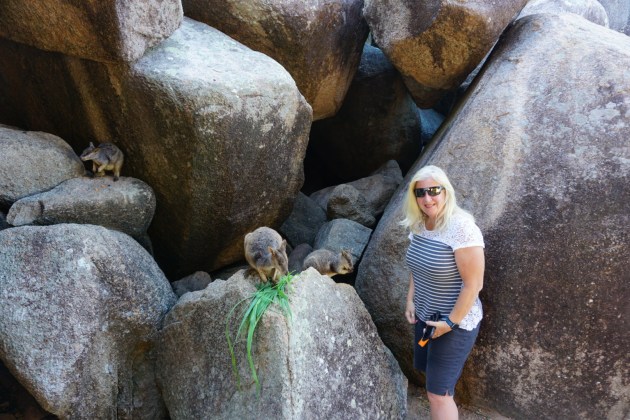
After a quick 20 minute ferry ride, we headed out on foot to go get the car.  Before long, we were off and running before 9:00 a.m.  Our first point of interest was Geoffrey Bay which is home to numerous rock wallabies.  We had stopped and purchased a carrot in order to feed them an “approved” treat.  Since we were there early, there were hardly any people around, so we had the experience all to ourselves.  We saw momma’s with joeys in their pouch (and miscellaneous body parts hanging out at an given time) along with some youngsters.  The youngsters were the most brazen of the bunch (kind of like human teenagers).  They had no qualms about coming up and grabbing the carrot pieces out of our hands.  At one point, I pulled my hand back to draw one closer, and he grabbed my finger with his tiny little clawed fingers and pulled my hand back towards him.  They were so unbelievably cute!  Oh how I wish I could bring one home!

Wild rock wallabies that have gotten used to handouts
The younger ones were bolder
What fun!

As more and more cars flooded in, we took that as our cue to leave.  We were then headed to a hike that took you through the eucalyptus forest (with wild koalas) and up to a fort used during WWII.  As we drove through, both the parking lot and the overflow lot were packed full.  There was nowhere to park.  We decided to move along and come back for a try later.

We headed to one end of the island and a beach called Horseshoe Beach.  Despite having to swim within the netted areas to avoid box jellyfish stings, the beach was packed with visitors.  We wandered around a bit taking in the sights and trying to figure out our next move.  We had specifically rented a 4 x 4 to check out some amazing views in hard to reach places.  Unfortunately, the one road with all the best views had been closed because no one wanted to bother fixing the 3 foot deep potholes that riddled it.  Such a bummer.

From there, we decided to check out the fort hike one more time.  This time we lucked out and scored a spot as someone was leaving.  The downside is it was later in the day and quite toasty out.  The hike was only a couple of miles, but getting up to the sights of the fort was a lot of ascent on rocks and steps.  We were definitely a little worn out and sweaty by the time we got to the top, but the views were amazing.  From the very top, you could look out the gun slot for a full view of the Coral Sea and any approaching enemies.  Along the way, we were able to spot a few koalas up napping in the trees.

View from the shore artillery emplacement. Probably unchanged since WW2
Remnants of artillery installed to protect against a Japanese invasion that never materialized.
Artillery storage magazine
Wild Koalas surround the fort
Koala watching us from his nap spot
So adorable!
Koala fast asleep on his gumtree perch

We finished our exploration of the island by driving to the west end, down a 4 x 4 road to some very remote beaches.  Here, there were no lifeguards or nets.  We were told by the rental car agent NOT to swim here due to sharks.  Yep, no problem there!  Sorry, I will not be treating you to any up close and personal pictures of Great White Sharks….I know, disappointing.  We quickly discovered it didn’t take long to explore the charms of this island, and after about 5 hours, we headed back to the ferry and camp.

Beers on the beach to celebrate a fun day on the island
We went to seven of the eleven points on this sign this trip!

We still had Easter Sunday booked at this campground, but we were finding that it was too far to walk to any sort of restaurants or entertainment.  Other than walking the beach or sitting in the campground, that was about it.  We were booked for a beach spot about 4 1/2 hours away on Monday but started discussing pulling up camp a little early.  Dan made some phone calls and we lucked into a real campground (not a spot on the beach with no amenities or power) on Easter Sunday and Monday.  Since we have been winging this entire trip, we have been very fortunate!  Unfortunately, the campgrounds are very good about getting their money up front, so we did eat two nights in two different places by changing our plan, but it was sooooo worth it.

On Easter Sunday, we arrived in Cape Hillsborough and our spot right off the beach.  This was on our list because the wallabies and kangaroos come up on the beach before sunrise to eat.  They have also been known to wander the camp foraging.  Here, the tidal shifts are quite dramatic, and we were warned to make sure we were attentive to the tides on our beach hikes.  It was low tide when we arrived so we took a nice long stroll down the beach.  The campground was packed to the gills with large groups and families yet again.

Walking the tidal flats of the beach. All of this is covered by sea water at high tide. Hikers sometimes get stranded if they haven’t paid attention.
Kangaroo visitor to our campsite
Kangaroo and kookaburra bird that stopped by.

Monday morning, we were up by 5:30 a.m. and headed to the beach.  The wallabies and kangaroos were already there chowing down.  It was such a cool treat to watch them along with the sun coming up over the rock formations.  Since the holiday weekend was over, most of the campsite had emptied out so we jumped on the chance to move to a prime spot with no one around us.  The next morning, Dan decided to head to the beach once again to see the kangaroos.  I opted to stay in my less than cozy bed.  It worked out in my favor anyway since two kangaroos decided to hang out and graze near the edge of our camp spot!

Wild kangaroos and wallabies the come to feed on the beach at sunrise.
What was that sound?
Enjoying the sunrise views
This kangaroo came to play in the water at the beach
Had the good luck to take a picture of one with a rainbow!

The next day we had an extremely long drive to Hervey Bay (8 hours) which meant I had to do some of the driving too 🙁  Once we got settled in, we took a long walk on a very long pier and took in the sights.  We then headed to the only restaurant open (as you can imagine, that did not turn out well). We really didn’t see much to hold our interest here, so we left the following morning and headed to Noosa Heads. This was my nightmare in living color.  It was very clearly School Break.  The streets became parking lots and every sidewalk was wall to wall people.  We hopped out in the nature park (Dan made me….I just wanted to get as far away from the chaos as possible) and did another hillside boardwalk through the eucalyptus trees and overlooking the ocean.  We covered a few miles, enjoyed the sights, and then quickly made our way out of town.  In a quieter time of the year, this place looked like it could be a lot of fun.

Urangan pier at sunset. It’s over a half mile long (868 meters) and makes a great sunset stroll
Noosa heads national park
Beautiful beaches of Eastern Australia

After leaving Noosa Heads, we arrived in Alex Beach and our next campground.  It was a very pretty campground with a great boardwalk that went on for miles.  We took in some of the memorial sites from various wars that we found along the boardwalk.  Once again, we did not find a big draw here (we had begun to find that the remainder of our journey was highlighted by very popular beach towns which really wasn’t on our “A” list of things to do and see).  As I am sure you guessed, we headed out bright and early the very next morning.

Alex Beach campground
Views from the highway to Brisbane

The next leg of our journey would bring us to Brisbane and the chance to catch up with some very special friends.  We met up with a couple that we got to know in Greece (our boats are in the same boatyard) and spent a few hours catching up over lunch.  This was definitely a highlight on our journey since they had been locked down and away from their boat for the last two years.  It was really great getting to catch up.  Since we still had a two hour drive to our next campsite, we were forced to say goodbye sooner than we would have liked.  Between road construction and traffic, our two hour drive took us 3 hours!  We were now in Byron Bay.

At this point, we have come to the conclusion that we have hit all of our bucket list points of interest.  We were both feeling quite worn out, very homesick (me), and not looking forward to the upcoming week of rain in our little camper van.  We decided to make our way to Sydney as quickly as possible and head home several days earlier than originally planned.  Before we left Byron Bay, we decided to hike to the lighthouse on the point.  Now that was a rough one!  No one mentioned the relentless hills and stairs that went on for miles to get to the lighthouse!  Once our hike was complete, we hit the road once again.  

Easternmost point of Australia at Byron Bay
Hiking to the lighthouse
Cape Byron lighthouse. Australia’s most powerful lighthouse and protecting the coast since 1901

We headed to the town of Port Macquarie for our last night of camping.  This was a very nice, quiet camp area with very few visitors.  The highlight of this visit was a visit to the koala hospital where orphaned and injured koalas are taken in to be rehabilitated before going back to the wild (if they can).  These are koalas that were injured in the big fires or hit by cars, etc. Some of the joeys (baby koalas) go to foster homes for more intensive care.  I so wanted to be a joey foster mom!

Koala that had been struck by a car and being tended to by volunteers at the Koala hospital
This koala was blind and is a permanent guest of the hospital

We were now on the last leg of our adventure (I bet you thought this post was never going to end)!  We spent most of this drive in relentless, pouring rain…..not fun!  After 4 hours, we finally arrived in the town of Clovelly.  We were very excited for this part of our journey as well because we would be meeting up with a distant cousin of Dan’s whose family was from the same island in Croatia as Dan’s dad.  We had never met him before, but he generously opened up his home to us and shuttled us around to some amazing areas.  We started across the river from the Sydney Opera House at sunset where we were treated to a fireworks show.  The next day we visited some of the very popular and famous surf beaches in the area.  Once again, our visit was far shorter than we would’ve liked, but it was time to get home.

Famous Sydney harbor with the opera house and harbor bridge at sunset
Reunion of Muzich’s from the Croatia island of Cres in Australia

We left at 9:00 a.m. on Tuesday and arrived in Phoenix at 10:00 a.m. on……Tuesday!  Gotta love the international date line, now my days of the week are ALL screwed up!  All I can say is that it was a magical trip, but I am happy to be home once again (even if it is for only a month).  In the end, we drove over 4500 miles in a little less than 5 weeks.  For those of you in the U.S., that is the equivalent of driving from  Boston to Anchorage, Alaska!  

For now, we will say good-bye until the end of May when we return to our boat in Greece.  We hope you will join us on this year’s sailing adventures which will hopefully take us to Sicily and the surrounding islands.

Bound for the Australian Rainforests

After turning in our very comfy motorhome in Alice Springs, we hopped on two flights (Alice Springs to Brisbane, then Brisbane to Cairns) totaling about 5 hours in the air.  We were very excited for this next phase of our adventure down under.  I was treated to 2 nights in a motel when we arrived in Cairns.  Yes, I said treated.  After 16 days sleeping on a dinette turned bed, I was thrilled to sleep in a regular bed.  Since we arrived somewhat late on Saturday, and were scheduled to pick up our next camper van on Monday morning, we really only had 1 full day to explore Cairns (which we did in full)!

The beautiful city of Cairns in the northeast of Australia
The city has a lush tropical feel
Cairns by night. This tree had dozens of parrots roosted for the evening

We started our day early with a visit to Rusty’s Market which only takes place on Saturdays and Sundays.  Here there were a variety of food carts, craft stalls, and a huge assortment of farm fresh fruits and veggies (the whole reason we went).  We made it a mission to stock up on a variety of fruits we either couldn’t get at home or had never even heard of.  We had rambutans, passion fruit, dragon fruit, mangosteens, and custard apples.  Needless to say, we had to be taught how to eat several of these treats.  The custard apples were by far the ugliest fruit we had ever seen (and totally clueless as to how you would eat one), but they turned out to be one of our favorites.  It was quite a fun fruit adventure!  

All kinds of tropical delectables to try
Which one first? Hmm…

After taking our haul back to the hotel, we headed out on foot to the boardwalk down along the ocean.  Cairns is a beautiful little beachside town with great walking/biking paths and an awesome children’s water park that goes on and on.  Later that evening, we had an amazing dinner overlooking the ocean.  Our first real meal out….and a fancy one at that!  The next morning was going to be a big day.

Dinner views of the marina

We decided to try and pick up our camper van a little early, so we headed out on foot in the morning.  We didn’t even get a block before it started pouring rain….time to call an Uber.  We arrived at the rental place the same time as several other groups, and wouldn’t you know, we could not check out early.  On top of that, we couldn’t stay inside because there were too many people per the Covid rules.  So, several of us stood outside, under a small awning to shield us from the rain, for close to an hour.  Finally, it was our turn to check out our camper van.  This was not going to be easy after getting super comfy with our big RV.  We were back to living in a van 🙁  This time, for 3 weeks!!!  Ugh….just shoot me now.  As we were telling the woman at the rental place where we were headed, she asked if we planned to swim or snorkel.  We told her probably not.  She then replied, “Good. Don’t.”  We were headed to the home of Box Jellyfish, Great White Sharks, and Saltwater Crocodiles!  She basically told us that if no one was on the beach or in the water, then we should not be either.  Gulp! I just found even more ways to die in Australia!

Guess how many empty beaches we saw?  ALL OF THEM!!!

From Cairns, we headed north to the Daintree Rainforest.  To get here, you have to take your vehicle onto a river barge to get to the other side of the Daintree River (did I mention the river is infested with Saltwater Crocodiles?).  We weren’t entirely prepared for the heat and humidity that greeted us (shocking, I know).  It was also pouring rain, and we no longer had a rig equipped with air conditioning or space to hang out when the weather was bad.  This was not going to be fun!  Luckily, Dan found us a campground that had beautiful grassy grounds and a few covered campsites.  We opted for the covered spot so that we could at least sit outside despite the rain.  Unfortunately, the cover did nothing for the wicked heat and humidity (it actually made it worse).  We had originally planned to spend several days up in this area, but it was not looking like that was going to be a possibility given my lack of heat tolerance.

Ferry across the salt water croc infested Daintree river
We followed this road to it’s end in Cape Tribulation
Surreal drive through a tropical rainforest
Views of the Coral Sea
Campground number one for this part of the trip
We found a campground with rain protection which came in handy!

We left our site in the morning and headed out to do several different walks and skywalks through the rainforest.  On one skywalk in particular, we were in search of the famous Cassowary.  This is a giant, prehistoric bird that looks somewhat like an ostrich, except it is far more colorful.  It also has this odd, solid structure on the top of it’s head and a razor, sharp claw on it’s feet.  The Cassowary has been labeled the world’s most dangerous bird (go figure) and is capable of eviscerating you with those claws.  Unfortunately, we did not find any Cassowaries (but I did see way more spiders than I ever wanted to).  

Orb Weaver and it’s spider web. These things are huge.
Every where you look, there is a spider not far away
Wandering the Daintree rainforest
Climbing an observation tower to get a rainforest canopy view
Incredibly lush
There are cassowary birds in this forest but this is the only one we “found”

From there, we headed to Cape Tribulation, the furthest point north that you can drive following the coast.  We headed down to the water for a quick peek (also watching for crocodiles), then did another rainforest canopy walk.  As we made our way back to the van, Dan decided to take a short cut between two trees.  I almost followed, but then decided my good sense dictated I stay on the path to the correct walkway to the car (only another 20 feet or so).  When I got to  the car, Dan was dancing around frantically like his head was on fire.  He had managed to walk through THE BIGGEST spider web ever and was terrified that the spider had come with it.  Luckily the spider was still up in his web (and by far the biggest spider we have seen so far!  He was like the size of an adult hand)!  The web was nearly impossible to get off of Dan because it was so sticky and filled with yellow goo!  ACK!  So glad I didn’t follow him (insert big shiver here).

Tarzan made this look easy
Empty beach deep in saltwater crocodile territory
This spider and it’s huge web ensnared Dan much to both of our chagrin!

We headed back across the river barge down to a riverboat tour on the Daintree River.  Here we would be searching for the Saltwater Crocodile.  The Daintree River is a 120 kilometer river that is freshwater at low tide and salt water at high tide.  When the tide comes in from the ocean, the water level goes up by 2.5 meters (8.3 feet)!  It is very brackish which makes it the perfect hangout for the Saltwater Croc.  We motored around the river and came across 1 large male croc and a few babies, but that was about it.  It definitely wasn’t the most impressive crocodile tour we’ve done.

Daintree river salt water croc tour
Fifteen foot long salt water crocodile
Baby salt water croc

Next, we drove to the Kuranda Rainforest.  At this point, all of our campgrounds have been quite nice….until now.  This one was tucked deep into the rainforest (nice) but the facilities were not so great, and the permanent residents far outnumbered those of us camping.  After my cold shower in the dark (no, not my choice), this was a one and done.  We headed off bright and early for Kuranda Village.  This was a great little town with all kinds of cute little shops and touristy things.  We decided to do the Koala Gardens.  This was basically a glorified, miniature zoo.  However, we did get to see the koalas up close as well as a number of other animals.

Barron gorge near Kuranda
Our campsite in the Kuranda rainforest
Feeding some wallabies in the local nature park
It’s the kangaroos turn!
This one gave Robyn the cold shoulder
Koala bear!

At this point, we decided it was time to come down out of the rainforest and head to the Atherton Tablelands.  We found this awesome camp area that catered to “gray nomads”.  Yep, that is literally what they call themselves (not sure I care to be called that).  It was a beautiful spot and meticulously clean and well kept.  The camp kitchen had everything you could imagine and was a unique experience in and of itself.  

Fanciest camp kitchen of the trip so far

After leaving the camp early the next morning, we headed out in search of a platypus.  There were 3 specific areas where they were known to be found.  Unfortunately, it was raining again.  We walked the banks of the first river….no platypus.  We walked the banks for another river….no platypus.  We finally went to a pond area and paid to go in.  After standing in the pouring rain, we finally got to see this elusive little guy.  They are quite odd looking.  If you have never seen one, they are a mash up of a venomous, egg laying, duck billed, beaver tailed, otter footed mammal.

Searching for platypus in the river
If you say so!
Found one!

The Tablelands are also known for their abundance of mango plantations, banana plantations, creameries, tea plantations, coffee plantations, and wineries specializing in exotic fruit wines and liqueurs.  So, that adventure was next on our list for the day.  Since there weren’t enough hours in our day, we chose to visit a coffee roaster/chocolatier, 2 creameries for cheeses, and a tea plantation.  I know….you’re speechless that we skipped the wineries!  We propped up the Aussie economy by buying treasures from each and every place.

Tasting a variety of hand cut teas
Tea plants as far as they eye can see
Millaa Millaa waterfall

We made our way out of the Tablelands by early afternoon and drove down the coast to a place called Etty Bay.  We were extremely lucky to be able to score a camp spot at this tiny beach area on Thursday because they were completely booked up for the entire Easter weekend.  This spot was a very important score for Dan since he read that you were sure to see Cassowaries roaming the beach at dusk and dawn.  No sooner had we parked our van and opened the door, and a Cassowary wandered by our van.  Holy crap!!  He was right there!  He was obviously very use to people as he freely roamed all over the campground trying to steal food.  At one point, a large group of people were sitting under their awning, and he strolled right in.  That sent the entire group scattering and squealing (he may be comfortable with people, but he is still dangerous).  We were beyond excited to finally get to see one up close and personal.  I came really close to walking into him the next morning as I distractedly talked on the phone.  I looked up just in time to stop dead in my tracks.

Giant cassowary bird in the campground!
The prehistoric looking bird came right by our beachside camp!
They have razor sharp claws and a few Aussies get injured every year.
Rain soaked laughing Kookaburra bird. Neither of us were laughing at all of the rain we had!

Down on the beach, there was a big net out in the water.  We quickly learned that this was a jellyfish net, designed to offer a protected area for people to swim and play in the water.  This was a big no thanks!  There was a crocodile warning sign here too.  We spoke with the lifeguard who informed us that a croc had been caught in the net the day before.  She proceeded to tell us it was a small one….only 2 meters!  Ummmm, 2 meters is way bigger than I want to encounter!  We asked about walking on the beach and whether or not it was safe.  She basically told us it was okay to walk on the beach but stay away during dusk and dawn.  She said that was like feeding time at the zoo.  Ooookay, note to self…..STAY OFF THE BEACH!!

A salt water crocodile got entangled in the beach safety net the day before.
Warning signs at the beach. Umm yeah no need to go in the water for us!

So, that brings us to the end our rainforest and tablelands excursion.  We have seen and experienced some amazing things in this incredible country.  We have 2 more weeks in our camper van to make our way along the east coast back to Sydney, so stayed tuned for more adventures in Australia.

Adventures in the Outback….Australia Part 2

Welcome back!  After 8 days with our tiny home, we pulled into Melbourne to drop off our little caravan and pick up our next “home.”  This was truly a luxury vehicle!  A class C RV motorhome that sleeps 6 (mind you, not overly comfortable if you are 6….but plenty spacious for 2).  Here is the crazy part….we signed up for a relocation deal which has some definite perks, as well as at least one big downside.  So what this boiled down to was we got this amazing “home” for 8 days, for the whopping sum of $1 dollar a day.  Yep, you read that right….$1 dollar per day to rent this baby!  But, let’s not forget the aforementioned downside 🙁  The downside was that we had to move the vehicle 1700 miles over 8 days….yikes!

Moving day! From small to much larger!

At this point, I have not driven here in Australia.  For those who know me well, you know how much I hate to drive in my own country where I have a firm grasp on what I am doing!  Since this leg of our journey required many long hours behind the wheel, we agreed that I would share in some of the driving….gulp.  Dan and I decided to log as many miles as we could up front, so that we could have some down days to enjoy this beautiful country.  Since it was somewhat late in the day by the time we did all the vehicle switching, we decided to drive 2 hours and grab a camp spot for the night.

Robyn’s turn at the wheel. “Look right and drive right” was our mantra!

The next day we got an early start from our spot in Nhill and drove 8 hours straight into the outback via the Barossa wine country.  I took the first shift which worked out well since we were one of the very few cars on the road.  After “backseat” driving Dan for the last week, I felt pretty skilled driving my big rig from the right seat on the left side of the road!  One of the freakiest things we’ve encountered on our drives are these rigs called Road Trains.  They are basically a semi with 3 attached cargo trailers.  They are scary to pass since they are so long, and when they blow by you, you feel like you are going to be blown off the road.  Needless to say, we tend to hug the shoulder when we see one approaching and hang on tight!  The terrain in the outback is quite spectacular with it’s wide array of colors and features.  We expected to encounter a lot of wildlife, but unfortunately everything we saw on this day was road kill 🙁  At this point, the only wombat and kangaroo I’d seen were deceased…..so heartbreaking.  After our long drive, we opted for a “wild” camping spot which was down a red dirt road, in the middle of nowhere.  Knowing all the deadly things that lurk in the outback waiting for me, I wasn’t overly keen to go exploring on foot or hang out outside.  I know….what a wimp!

Welcome to the Outback!
Wish you could tie off the wheel and set the cruise control.
Our first wilderness camp spot in the Outback. Kangaroo and snake tracks were everywhere but we didn’t see a Roo until with we left the next morning.
Can’t complain about the locale!
Sunset from our camp spot

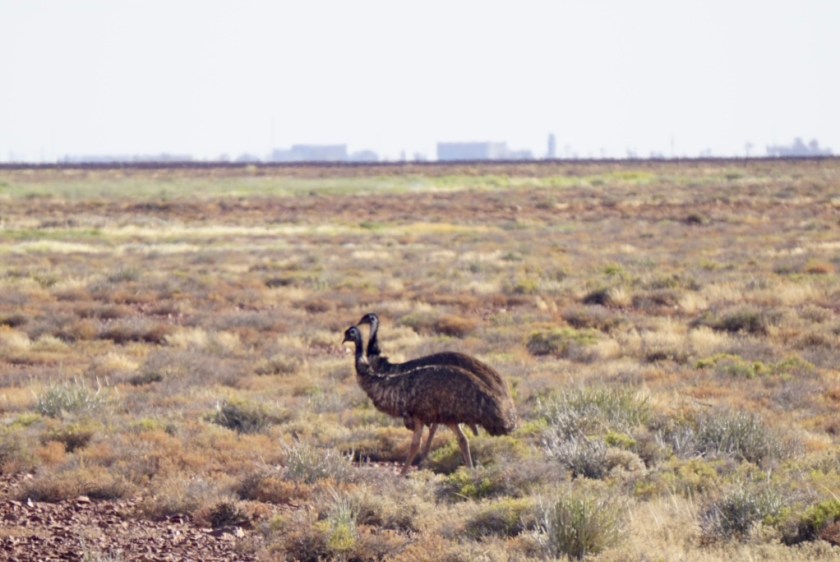
We were up with the sun the following morning and on the road again.  Once again, I took first shift.  I kind of liked having the road all to myself.  Since we were out and about at sunrise, we were treated to some kangaroos and a number of emu.  The kangaroos were messing around in the roadway, so by the time we got close enough (very slowly), they had disappeared into the brush.  It was very cool to finally get to see some alive and well.  On this day, we planned to cover 5 hours to the town of Coober Pedy.  Along the way, we stopped at a salt lake (we’ve seen quite few of these here) and walked out onto if for some pictures.  They are really an unusual landform out here in the middle of nowhere.

“Lake” Hart – a salt lake used in movies like Mad Max
An Emu couple in front of the secretive Woomera missile test facility.

Before long, we were approaching the town of Coober Pedy.  Before you even arrive, you are surrounded by very odd piles of dirt that cover the landscape as far as the eye can see.  There are also a multitude of signs warning you of the dangers surrounding these big dirt hills.  We have now entered Coober Pedy which claims to be the Opal mining capital of the world and home to over 70 fields.  The name Coober Pedy means White Man in a Hole.  Seems rather appropriate!  In addition to all the mines, much of the town is built underground and tunneled into hillsides.  We took some time to go explore an old mine turned tourist attraction which housed many artifacts and recreated the life and times of a miner and his family.  We then hiked to the top of Big Winch 360 where we were treated to 360 degree views of the countryside.

Coober Pedy – started as “Kupa Piti”, which is aborigine for “White Man Holes”
There are thousands of mineshafts in the area- and they are not marked!
Felt a bit like Mos Eisley from Star wars to us.
Some old mining equipment rusting away
A former Opal mine turned tourist exhibit.
Exploring the mine shafts that miners looked for Opal treasure.
The area is scorching hot in summer so miners lived underground with their familes. Here Robyn is in a kid’s bedroom in use until the 1960s
The underground homes had multiple bedrooms, kitchens and bathrooms.
Miners had to exit the mines via vertical shafts with footholds chopped in the sandstone
There are miles and miles of mine shafts under the ground. All dug to look for Opal.
Waffles and Opals. Why not?

The other draw to this small town is the landscapes which are certainly out of this world.  Many movies have used this unusual landscape for their shoots, including Mad Max, The Red Planet, and Ground Zero just to name a few.  A short drive out of town had us clanging down a washboard, red dirt road to some of the craziest landforms imaginable.  This was an Aboriginal heritage site known as the Breakaways which boasts unusual land formations and a wide range of colors that change with the light of the sun.  Along one part of the site is the world’s longest fence.  Here you will find part of a 5300km dog fence that was built to keep the Dingos out of the south where the cattle and sheep roam free (unfortunately, it didn’t stop a few cows from encounters with high speed trucks).  After thoroughly exploring the Breakaways, we followed the bone jarring dirt road back to the highway to continue our trek.  Our next stop was the town of Kulgera in the Northern Territory.  Here we spent another creepy night out in the bush (it was a beautiful site despite the thousand ways I conjured up to die painfully in Australia….haha!)  At one point, I even yelled at Dan who was busy wandering around in the brush at dusk.  Crazy man!

The desert landscape was used for many movies, for which some props were left behind.
Piles of rubble from the thousands of Opal mine shaft in the area
We took the motorhome down a long stretch of teeth rattling washboard dirt roads
Looking out over the “Breakaways’, a surreal landscape.
Longest fence in the world. Built to keep the dingoes (wild dogs) away from the sheep
After hours and hours of driving finally made it the Northern Territory border
Camping in the wilderness near Kulgera, Northern Territories.

Once again, we hit the road at sun up.  Our next destination was the famous world heritage site of Uluru.  As we drove there, we were treated to  hills and soil that ranged in color from grays, to deep purples, to fiery reds which changed as the sun moved in the sky.  We arrived at our campsite nestled in amongst some very nice hotels and one lowly gas station.  As you can imagine, filling up this big RV at that particular gas station was quite painful!  It was $2.90/liter or $9.00/gallon!  OUCH!!!

Ouch – over $9 US dollars a gallon to fill up!
The first rock feature on the road to Uluru – “Fool-uru” Fool’s Uluru. Just a mesa.
Camping near Uluru at the Yulara campground
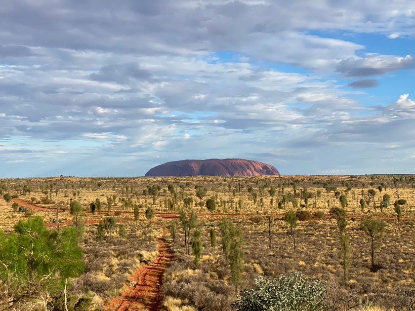
First view of Uluru. Quite the beauty!

Our first full day in Uluru/Ayer’s Rock, we headed out to the monolith itself.  This is known as the world’s largest monolith and is sacred to the Aborigines.  We decided to do the almost 7 mile walk around the circumference of this giant rock.  The colors changed with the movement of the sun and clouds, and we were treated to a variety of unique features.  Luckily we had bought some head nets the day before because the flys were horrendous.  They hover around your head trying to get into your ears, nose, eyes, and mouth.  They are so relentless it nearly drives you insane.  There were numerous areas where photos were forbidden because the rocks tell the stories of the aboriginal people to be handed down in person to their future generations and not shared through photographs.  In addition, there are sections strictly for the men and others for the women.  We were not able to get up close to any of these areas.  Later that evening, we headed to a spot dedicated to watching the sunset over Ayer’s Rock.  Once again, we were treated to the changing colors of this giant monolith as the sun set over the horizon.

View on the drive to the trailhead
Part of the magic of Uluru is how it changes color throughout the day.
Mutijuju Walterhole nestled against the rock
The “Kitchen” where aborigine woman prepared meals
The rock changes form and look as you hike around it.
Aborigine rock art
The flies can be pesky so a net can help.
It was magical to hike around the base.
The walk around Uluru was surprisingly lush at times
Banksia flowers
Before and after sunset pictures
A great finish to a special day

The next morning, we were up super early in order to drive a 1/2 hour to a sunrise viewing spot to witness sunrise over Kata Tjuta (the Olgas) another rock formation.  Coincidentally, we could also see sunrise over Uluru as well.  Once the sun was up, we headed up close to Kata Tjuta to do a little bit of hiking.  We didn’t last very long as the wind was just howling (ironically named Valley of the Winds), and the terrain was a little bit treacherous.  Thanks to the wind, the flys were not near as bad.  After the our short exploration of Kata Tjuta, we decided to end our stay in the outback and head to Alice Springs since our time in the RV was coming to an end.

Sunrise over the Olgas – Kata Tjuta
Sunrise next to Uluru in the distance
Starting the “Valley of the Winds” hike

After 5 hours of driving, we found a lovely little campground outside Alice Springs.  A super friendly campground host guided us to our spot, and I jumped out to guide   Dan into the spot since there were many trees.  As I directed him as close to the tree as possible, making sure he didn’t hit the top on the low branches, I looked up and saw the biggest spider I’ve ever seen right above my head.  Needless to say, I squealed and did my “eww, creepy spider” dance out from under him only to find myself under and even bigger one!  The camp host and all our neighbors busted up laughing at the goofy American girl terrified of spiders.  The camp host repeatedly assured me that these Orb spiders were not dangerous.  Ummm…..don’t care!  Ewwww!  I’m pretty sure I’ve seen more spiders in this campground than anywhere else on our journey so far.  Once settled and chores completed, we walked next door to this really fun brewery for some dinner and local beers.  It was a great way to end the day.

Made it! 3094 kms (1922 miles) from Melbourne.
Our last camp spot with this motorhome. Alice Springs and lots of spiders!
The Australian Giant Orb weaver spider – and source of Robyn’s Giant nightmares!
Our campground was next door to a nice craft brewery with local Barrmundi fish and chips.

We had now arrived at the end of this leg of our journey.  We needed to prep the RV for turn in and check into our hotel room for the night.  The following day we would be flying to Brisbane and then Cairns for the final 3 weeks of our journey.  We arrived at our hotel around 12:30 but were told we could not check in until 2:00, so we dropped our bags and headed out to turn in the RV.  We walked back to the hotel around 1:30 and asked once again.  Still no rooms were ready, so the girl handed us 2 free drink coupons for the bar onsite.  We headed over and grabbed a beer and burger.  Long story short, our room was not ready until nearly 4:30 and we were given 6 drink coupons to keep us occupied….lol.  Not a bad way to while away the afternoon!

Free beers (courtesy of hotel) and Australian Rules Football.

That night was opening night of Parrtjima Festival which is an annual Aboriginal Cultural Festival.  We hopped on a very crowded shuttle bus (standing room only and my most favorite thing in the world to do) and headed to the festival as darkness set in.  As we entered the outdoor venue, we were treated to some beautiful light displays throughout the desert.  The centerpiece of the festival was a light and sound show that took place on the McDowell Mountain Range displaying aboriginal art, music and story canvased on the mountain.  After exploring the festival, we stood in a long line to once again crowd on to an overstuffed shuttle bus home.  Tomorrow would be an early start and a long day of standby flying….2 flights totaling over 5 hours 🙁

Alice Springs desert park kangaroo
Wedge tailed eagle
Same eagle showing us how it breaks open hard Emu eggs with rocks
Australian Emu
Joining the hordes for a nighttime light show in Alice Springs
They did a great job translating Aboriginal legends into light
Very impressed!
Bamboo turned into a tunnel of light
The McDonnell mountain range ringing Alice Springs was lit up as well!
Met a local Aborigine woman and enjoyed leaning her culture first hand.

When we meet again, we will take you back to the sea and through the rainforests of Australia!

Adventures in Australia: Part 1 (with Hawaii bonus)

It’s been some time since we’ve had a true adventure to write about. Since leaving Greece last October, we’ve spent time reconnecting with family before heading off to Maui for the months of December and January. The house that we are having built has fallen very far behind schedule which has left us scrambling to find alternate living accommodations so as not to be too big of a burden living with very generous family members and friends. I chose not to blog about our time in Maui, since we basically lived like residents….cooking meals at home, going to the gym, going for walks, and sitting by the water reading. We did have a great time there doing lots of hiking and enjoying daily visits from the Humpback whales and sea turtles. Here are a few pictures of some of our favorite moments.

Hiking the martian landscape of Haleakala volcano
Aptly named Sliding Sands trail.
Makawao Rainforest Reserve
Primordial views
Humpback whale breaching off Maui.
Dan took a free diving class and learned how to dive down past 30 feet in depth

That brings us to now, the last week of March, and Dan’s clever crafting of another wild adventure.  After many, many hours of research, Dan devised a plan in which we pick up 3 different one-way camper vans throughout Australia and drive/explore a circumnavigation of the Southern and Eastern part of Australia over a 5 week period of time.  When it is all said and done, we will have driven 3600 miles not including the side diversions to explore the surrounding areas.

Long day to get from Phoenix to Los Angeles to Sydney….luckily we got upgraded (as standbys) to Premium Economy

So, let’s get started!  It took us 16 1/2 hours on airplanes (and the complete loss of one day due to the international date line) to arrive in Sydney.  Since we ended up leaving 4 days earlier than our original plan, we did not have anything booked.  As soon as we were on the ground, Dan began making phone calls to secure us a camper van.  By late morning, we were tucked into our tiny home and on our way to our first stop in the Blue Mountains.  It was pouring rain and very foggy.  We spent two hours driving with me regularly chanting, “look to the right, drive to the left.” You may be asking yourself why I was doing such a strange thing?  Well, not only was Dan having to drive from the opposite side of the car, but you also drive on the opposite side of road here, something with which we have very little experience.  Kudos to me for not saying “the wrong side of the road.”  Before long, we were at our camp spot surrounded by lush, green forests, low hanging clouds, and a very odd cacophony of wild bird sounds (very Jurassic Park sounding).

Our little campervan for the next eight days

We headed out on foot to explore a variety of lookout points at a place called Katoomba Falls.  The views were amazing and quite eerie.  The cliff walls plummeted deep beyond the ability to see bottom, and the clouds whooshed up from below on the wind.  The waterfalls were spectacular to say the least, and unfortunately the pictures just don’t even come close to demonstrating the beauty we observed.

The beautiful Blue Mountains outside Sydney
Waterfalls everywhere
Making the most of the rain and fog!
The views were stupendous once the clouds cleared

The next morning, we were awake at 4:45 a.m. (thanks jet lag), so we decided to head to the Three Sisters rock formation for sunrise.  According to Aboriginal legend, 3 sisters were turned to stone because the 3 girls fell in love with 3 brothers from a rival tribe.  When the 2 tribes went to war, a witch doctor turned them to stone in order to protect them, but the witch doctor was killed in battle thereby leaving the 3 sisters forever in stone and creating this very unique rock formation.  The view is suppose to be spectacular.  Why did I say “suppose to be?”  Did I forget to mention that since we have arrived, we have had non-stop, pouring rain?  Needless to say, the entire area was so clouded in that we could barely see our hand in front of our face.  We were quite disappointed.

From the Blue Mountains, we headed south to the coastal town of Shell Harbour where we managed to score a camp spot right on the ocean.  Again, we had lots and lots of pouring rain but were treated to about 8 waterspouts of varying size out on the ocean.  It was fascinating and a little terrifying watching them grow bigger and more powerful (very glad we weren’t out on a boat!)

Some serious waterspouts!
There are four active waterspouts in this picture!
The birds are gorgeous down under
Oceanside dinner for two!
Rain, rain go away come back some other day!

After 2 days in Shell Harbour, we drove 4 1/2 hours to the town of Merimbula and our cliff side camp spot.  This was another quaint little beachside town.  Unfortunately, this was a quick one night stop before another 4 1/2 hour drive further south.  We made a quick stop at a town called Lakes Entrance where we bought fresh prawns right off the boat.  We literally walked up to the fishing vessel and purchased a kilo of prawns.  We had the choice of raw or freshly cooked, so we chose the cooked ones.  They were delicious.  After walking the boardwalk, we headed to our next camp spot in the town of Paynesville.  We planned for a two night stay here (thankfully….I’m getting a little tired of all the driving….or more accurately, passengering).

Friendly fellow who sold us a kilo of fresh caught prawns
Yum!

This was a 2 day stop so that we had time to go across the river to Raymond Island.  There is a free ferry ride that takes you across the river (a whooping 2 minute ride) where there is an abundance of amazing wildlife.  Raymond Island draws a lot of nature lovers because it is one of the best places to spot koalas in the wild.  So, a koala spotting we did go.  We walked 6 1/2 miles all over the island looking for koalas.  They are a lot tougher to find than you might think!  In the end, we did end up spotting 8.  Most were sleeping since they are nocturnal, but we did encounter 3 that were alert and 1 was busy eating eucalyptus leaves.  Our necks were definitely tired by the time we were done.  We also spotted a kookaburra, pelicans, and an endless array of wild parrots.  Sadly, we did not see any kangaroos this time.  After that adventure, we treated ourselves to a local fish and chips place for a late lunch.  Unfamiliar with the local fish by name, the cook suggested we get one whiting and one gummy shark.  They were both pretty good, but I much preferred the whiting.  The shark was much thicker and denser than the delicate flake of the whiting.

Ferry to Raymond Island
Start of the Koala walk. They are wild but plentiful enough that if you look around hard enough you will find some
Hello there! Hope we didn’t wake you up from your nap!
They are surprisingly hard to find high up in the gum trees.
Kookaburra bird
Snug as a bug
So. Many. Parrots!
Can you spot the Koala?

Our next stop was this awesome beach town of Phillips Island.  Unfortunately this was only going to be an overnight stop, so our day was cram packed with activities after a very long drive.  After pulling into our beach front camping spot, we walked the beach to town and explored for a few hours.  Not long after, we headed up to a place called Nobbies.  This is a spectacular cliff top view of the Bass Strait.  The wind was absolutely wicked, and I have never seen seas as violent and churned up as I saw here.  As the sailors once said (back during the age of the clipper ships), below 40 degrees latitude there are no rules and below 50 degree, there is no god.  We stood at 39 degrees south, so you get the picture.

The beautiful Nobbies
Nobbies blowhole
The winds were a bit rough on the point!

After enduring the high winds on the cliff side boardwalk, we took a back dirt road to our next adventure, the penguin parade.  Along the way, we were treated to tons of wallabys and one very shy echidna (also known as a spiny anteater).  We then made our way to the penguin parade.  This is a nightly event in which thousands of Little Blue Penguins (the world’s smallest penguin) come ashore after feeding from before sunrise to just after sunset.  These adorable little guys come into shore in droves (for self protection) and waddle their way up and across the beach where they head to their “bungalows.”  They are the cutest things you will ever see as they waddle their way past your viewing spot, stopping to check you out.  Unfortunately, taking photos was strictly forbidden so as not to disrupt their natural behavior, so you will have to settle for a photo of them from inside the visitor center.

An echidna (a spiny anteater – one of the few mammals that lats eggs). Poor guy saw us coming with the camera and tried to hide
Cute wallaby by the side of the road
Found this little guy on the way to the Penguin Parade
The above ground viewing area overlooking the beach. People have started to arrive to be ready for the penguin parade at sunset
We went with the underground viewing experience to make the most of our time there. Given the really high winds we were happy with the decision!
That’s a lot of Penguins!
Stock picture showing the viewing area (as photos were strictly prohibited lest some one let a flash go) (Credit: https://bunyiptours.com/blog/phillip-island-penguin-parade/)
Penguin Parade stock photo (credit: https://www.birdspot.co.uk/bird-watching-destinations/phillip-island-penguin-parade)

So, this brings us to the end of the first part of our journey.  We picked up our tiny home on Friday, March 25th in Sydney and drove 1023 miles to Melbourne to drop our tiny home on Friday, April 1.  We then picked up our much bigger tiny home to start the second leg of our journey.  Stay tuned to see what kind of mischief we get into next!

Overland exploration of Death Valley

While Zoe sleeps for the long, cold winter in the Med, we are here in the States. After a number of family events and holiday gatherings, we decided we were much overdue for an adventure. Next stop….head out and explore Death Valley by Jeep and Turtleback trailer.   This combo is perfect for the rugged 4×4 trails that the largest National Park in the lower 48 states is known for.  It’s a great park to explore in a 4 x 4 vehicle because of the dramatic changes in scenery within the park. The landscape goes from the mountain peaks towering up over 10,000 feet to the lowest point in North America, Badwater basin at 282 feet below sea level.

We enjoyed the trip, but we were quite surprised to find ourselves camping in the 20’s (-4 C) at night.  One morning we woke up to a frost covered tent…..INSIDE! Unfortunately, the high mountain passes were snowed in and icy.  We ended up aborting Dan’s goal of driving Lippincott pass to Saline Valley after talking to the rangers at the visitor center.  They said it was very icy at the pass and to drive it alone, like we were planning on doing, was extremely ill-advised.  Good to know 🙂   We ended up skipping the pass to Saline Valley in the hopes of returning one Spring to try again. So much for the “hottest place on earth”.

This coyote is a long, long way from any water. What a treat to come across him randomly in the wilds of Badwater
You can see why this stretch of Death Valley is called Artist’s Palette. What amazing colors…
The transformer toy of trailer campers about to expand out into a base camp with a week’s worth of fresh water, hot water heater, solar power, shower, propane heater, bathroom, kitchen and queen size bed
Titus Canyon Jeep trail
Through Titus Canyon
Inyo Ghost mine, high in the mountains in Death Valley
Inyo mine entrance. This mine must have been built by dwarves for dwarves. It was about five feet tall in there.
The mine was bored straight into the mountain
Inyo Mine abandoned cabin
Inyo Mine processing equipment
At the top of Inyo mine. Great Death Valley views.
Descent from Inyo mine…it was pretty steep!
Echo Canyon Jeep trail
Exploring Twenty Mule team canyon
Twenty mue team canyon
Shadow boxing in the canyon 🙂
Zabriskie Point
Headed to next campsite at Racetrack Playa
Teakettle Junction
Mysterious sliding rocks of Racetrack Playa. They leave a path dozens of feet long in their wake as they slide across the flats of the Playa.
We were treated to an impromptu airshow of F-18s engaged in low altitude simulated dog fighting (like something out of Top Gun). When it was finished, they topped up from a KC-135 tanker and left. Fun to watch!